Recently-renewed funding from NASA expands lake level project worldwide
November 30, 2019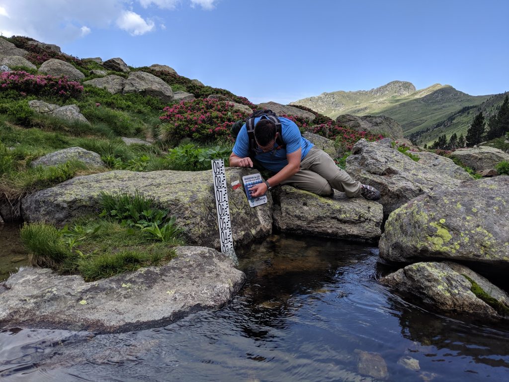
Continuing its pursuit of understanding water volume fluctuations in Earth’s natural lakes, the Lake Observations by Citizen Scientists and Satellites (LOCSS) project is finishing its first year of worldwide data collection following its recent funding renewal from the National Aeronautics and Space Administration (NASA).
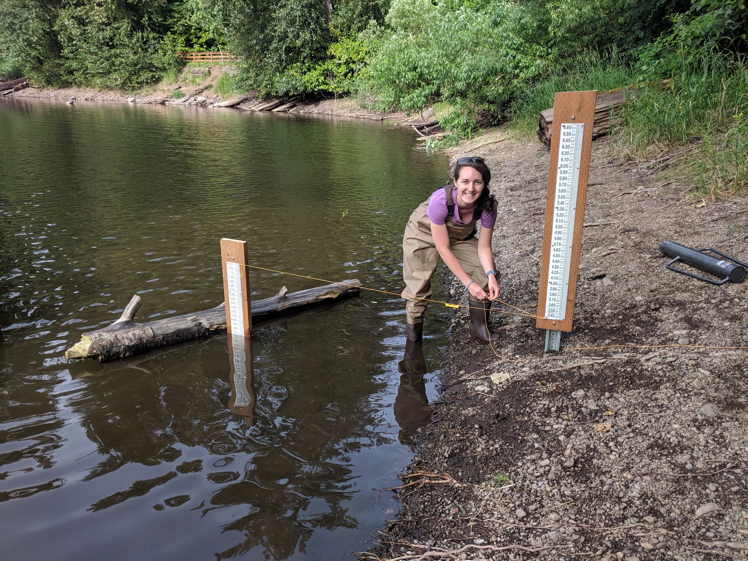
LOCSS is multi-institutional initiative that collaborates with citizen scientists to collect data on the everchanging water levels of the world’s natural lakes. Needing only to install a water gauge fastened to a plank of wood, researchers rely on the voluntary measurements of water height supplied, typically via text message, by local passersby. After texting the data to local phone numbers displayed on the water gauges, citizen scientists receive an immediate reply detailing the location’s previous lake level measurement.
Comprised of researchers from UNC Institute for the Environment (IE) and Department of Geological Sciences, University of Washington Department of Civil and Environmental Engineering, and Tennessee Technological University Department of Computer Science, this project initially started as a pilot grant proposal selected for funding by NASA in early 2017. Chosen alongside only 16 other proposals, the first year of LOCSS was dedicated to measuring water volumes of natural lakes in North Carolina through the efforts of local citizen scientists. The team presented its first-year results to NASA and the project was selected for additional funding to expand its research globally for three years.
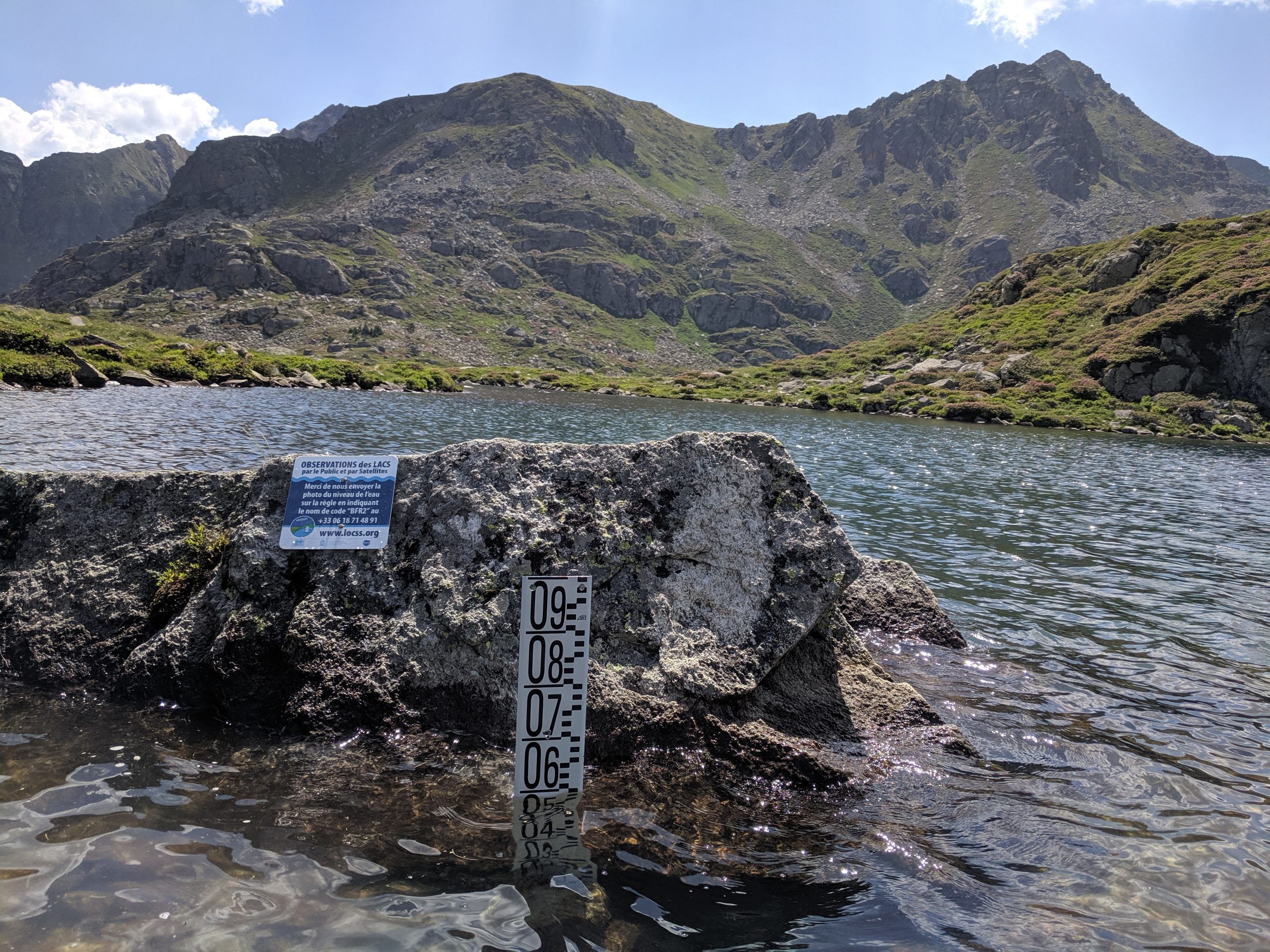
Since its funding expansion, LOCSS has begun monitoring lake level fluctuations in the Pyrenees mountain range in southern France, as well as in a handful of locations in Bangladesh. In the United States, in addition to the more than 13 lakes studied in North Carolina, lake levels are currently being monitored by LOCSS in Washington, Illinois and Massachusetts. The locations, measurements, and total responses of each lake are displayed publicly through LOCSS website.
To be considered for study, lakes must be natural and large enough to appear in satellite images. Some lakes are pristine, while others are surrounded by housing developments. The LOCSS team also considers the accessibility of the lake, as this impacts the likelihood that local citizen scientists will visit the area consistently.
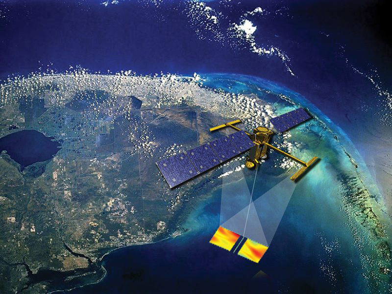
Deciding which regions to focus on is largely influenced by the anticipated pathways of satellites that will capture images of the earth’s surface water. The Surface Water and Ocean Topography (SWOT) satellite, for example, will be launched in 2021, and the orbiting patterns of satellites such as this one will help guide the LOCSS team in selecting lakes that fall within the pathways of these satellites. The on-the-ground data collected by the LOCSS team will be used, in turn, to confirm the visual changes in water surface elevation and inundated area in the images captured by the SWOT satellite. The team will also combine the lake area measurements derived from existing images captured by satellites such as Landsat 8. Studying changes in water height alongside surface area fluctuations enables better understanding of the changes in water volume of the world’s natural lakes.
To test the accuracy of the measurements supplied by citizen scientists, the team initially installed pressure transducers with the water gauges to automatically record water height while citizen scientists reported their data. Anytime a lake level measurement was delivered by a citizen scientist, the transducer provided an additional measurement in the same location within 15 minutes. After more than 300 measurements, researchers for LOCSS determined that the average citizen scientist error was 1.1 cm, falling just outside the 0.8 mm known error of the pressure transducer, thus proving the reliability of the citizen scientists’ measurements despite their lack of training from LOCSS researchers.
Researchers for LOCSS were also delighted by the high level of citizen science participation since the project’s launch. As of Nov. 20, a grand total of more than 4,701 lake level measurements were supplied by 1,054 different citizen scientists.
“We are very happy with the amount of engagement we have had,” says Grant Parkins, watershed education coordinator for IE.
When surveyed at the end of the first year of the pilot project, the majority of participating North Carolinians noted that their primary reasons for participation were to better understand the lakes around them as well as to contribute to scientific research in some way. In Washington, Parkins spoke with locals about their concern for the dryness of the past year and the low snow pack levels of Mount Rainier, as well as how these factors might impact key ecological features such as spawning salmon populations.
By the end of the second year of worldwide research, the LOCSS team intends to compile the data recorded from the citizen scientists and report these findings back to the community. These reports will include important details such as the total responses, highest and lowest measured water levels, and noticeable patterns derived from these findings.
“The focus of year two is reporting back to the general public – how do we show them that the work they have done is important, and that it is showing results,” Parkins explains.
Researchers at Tennessee Tech are also developing an app that will facilitate data collection by capturing and delivering measurements without relying on cell service. The hope is that this would enhance the reliability of lake measurements in remote areas in which it may take citizen scientists hours or days until they regain service.
Members of the LOCSS team are confident that the data provided by citizen scientists will help shed light on underlying patterns of lake level changes, a field in which there is a significant gap between the millions of lakes that exist around the world and the mere thousands that are actually monitored by scientists.
“We can use the data to understand how and why lake levels, especially in small lakes, vary,” says Tamlin Pavelsky, principal investigator for LOCSS and associate professor of geological sciences at UNC. “We are using the LOCSS datasets (citizen science and satellite in combination) to try to understand whether water storage in various lakes in a region increase or decrease together, or if they follow their own idiosyncratic pattern.”
With regards to the citizen science aspect of the project, the team hopes that engaging with locals and encouraging their participation in research will stimulate the curiosity of the general public and ensure that they remain well-informed about the latest scientific research.
“We are engaging the public with understanding their natural resources—things that they care about,” Parkins says. “We are doing our part to help build a more scientifically-literate society.”
Story by Dylan Morgan ’22
Dylan Morgan is an environmental science major at UNC and is part of the graduating class of 2022. This summer, he is working as a communications intern at the UNC Institute for the Environment. Morgan’s career aspirations combine environmental research with journalistic storytelling, particularly in the fields of ecological restoration and natural resource conservation.